

Jerusalem - Old City Walls
Built between 1537 - 1541, by Ottoman Sultan, Suleiman the Magnificent (1520 - 1566).
The walls are built on the remains of ancient walls and stretch for approximately 4.5 kilometers.
They vary in height from 5 - 15 meters with a thickness of 3 meters.
The walls contain 43 surveillance towers and 11 gates, 7 of which are presently open.
Lion's Gate - שער האריות known also as St. Stephen's Gate and Sheep Gate

The Arabic name is Bab Sittna Miniam, Gate of Our Lady, due to its proximity to the place where according to Christian belief, the Virgin Mary was born. Also called the St. Stephen's Gate by Christians, which was in actuality an earlier gate built on the same location.
Of much interest are the panthers (often mistaken for lions, cheetahs or leopards), which are found on either side of the gate.
The panthers are the emblem of the Mameluke Sultan Baybars (1260 - 1277), who was one of the Mameluke leaders that ruled the Holy-land between 1291-1516).
With the fall of Acre, in 1251 the Mamelukes were responsible for the eviction of the Crusaders from the land.
For Jews, this gate represents the unification of Jerusalem, as it was through this gate that the 55th Paratroop Brigade entered the Old City during the 6 day war, thereby liberating and unifying Jerusalem once more.
Sha'ar Harachamim - Gates of Mercy, שער הרחמים

Situated on the eastern side of the city walls. Built either by the Byzantines during Justinian's rule (527 to 565 CE) or during the Ymmayad Period (661-750), using Byzantine workers.
The gate is made up of two blocked archways, the southern arch is know as Sha'ar Harachmim, Gates of Mercy, the northern arch is know as Shaa'ar Hatshuvah, שער תשובה (Gates of Repentance). The Arabs adopted the name Gates of Mercy, which translate as Bab Al-Rahma. Whilst Christians refer to them as the Golden or the Beautiful gate.
Many reasons have been forwarded, as to why these gates which lead to the Temple Mount and Temple entrance, are blocked. Some theorists believe that the Fatimids blocked them for security reasons. Others believe that the opponents of Judaism blocked the gates to prevent the realization of the Judaic belief, that the Jewish Messiah will enter the Temple Mount though these gates. The placement of a Muslim cemetery in front of the gates would reinforce the later theory, as a Cohen (priest) cannot walk through a cemetery. However according to Jewish belief the Messiah comes from the house of David, and is not a Cohen (priest). In addition the ruling that a Cohen cannot walk through a cemetery, applies only to a Jewish cemetery.

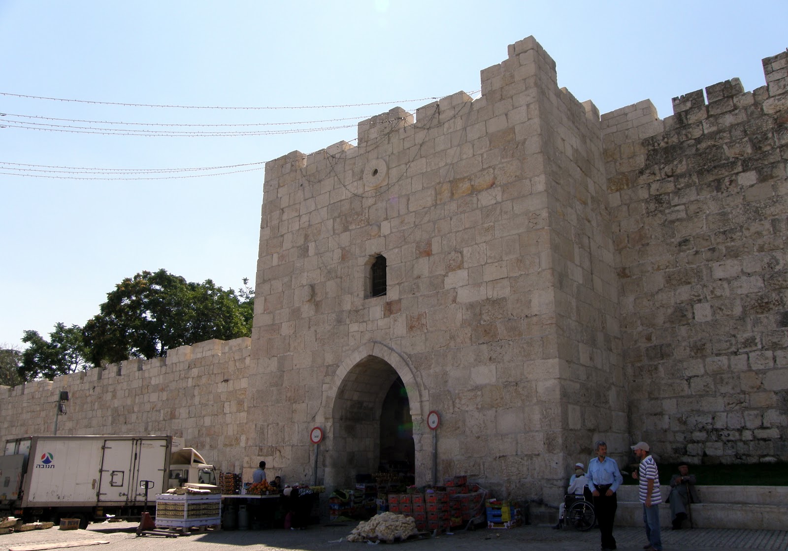
Dung Gate (Sha'ar Ha'ashpot, Gate of Silwan) שער האשפות

Situated on the south-east side of the city walls and built by Suleiman the Magnificent between 1537 to 1541.
Two theories have been forwarded as to why this gate is called Dung Gate. The first suggests that it was a place where Non-Jews deposited their garbage after the Second Temple destruction in 70 CE.
The name gate of Silwan, derives its name from the village of Silwan, which can be seen on the eastern side of the Kidron Valley.

Tanner's Gate Sha’ar HaBurskai שער הבורסקאים

A minor gate situated just west of Dung Gate, on the southern wall. So named as it it served as an entrance gate to the local tanneries, existent during the Crusader Period, (199 - 1291).
Zion Gate - שער ציון - Bab an-Nabe Dawud
+Bab+Harat+al-Yahud+Jewish+Quarter+Gate+Bab+an-Nabi+Dawud+Prophet+David+Gate.JPG)
Facing Mount Zion and Hebron, which is to the south of Jerusalem. Situated on the southern side of the city walls, it sits on the apex of Mount Zion, so that half of Mount Zion is within the city walls and remaining half outside the city walls. Built by Sultan Suleiman the Magnificent between 1537 and 1541. This gate serves as an entrance point to both the Jewish and Armenian Quarters.


The Flower gate is situated on the northeastern side of the city walls. The gate takes it name from the floral motifs on gate's facade.
Previously known as Bab- Al Sharia, in Arabic. (Gate of the Cemetery), but changed to Bab Al Zahira, meaning Gate of Flowers.
Named Herod's gate after either Herod the Great, or Herod Antipas, (his son).
Also known as Jeremiah's Den, as it is said that Jeremiah was imprisoned nearby.
Damascus Gate known as Shechem Gate / Nablus Gate / Bab-Al-Amud שער שכם

Built Between 1537 to 1541 by Suleiman the Magnificent, (1520 - 1566 CE).
Damascus gate is situated at the northern point of the upper and lower cardo.
Roman Emperor Hadrian 117 to 138 CE built 3 Triumphal Arch beneath the present gate, of which one arch is visible. Hadrian also erected a victory column in front the arches. Hence the Arab name, Bab-Al-Amud, This column is depicted on the Madaba map. The arches are built with secondary stones probably taken from the Temple Mount.
This was the Northern entrance to Jerusalem during the Crusader period 1099 to 1291 CE.
The Madaba Map

The Madaba map is a Byzantine Period (824-640), mosaic floor in St. George Church, discovered in Madaba, Jordan in 1884.
Originally measures 21 x 7 meters in size. It depicts, Lebanon, The Nile Delta,
the Mediterranean, Mo-ab desert, the Dead Sea, Bethlehem and bridges over the Jordan River.
Shown above, is a modern day copy of the mosaic, (which is found in the Cardo, in the Jewish section of the Old City). This shows the most detailed part of the original map, which
displays the Damascus Gate, Lions Gate, Golden Gate and Zion Gate, Church of the Holy Sepulcher, Tower of David, the Cardo and the Decamanus and New Church.


No comments:
Post a Comment
Your comments please;